I introduce the southernmost of Japanese mainland, Cape Sata. Panoramic view of Pacific Ocean from the steep rocks is wonderful! Personally I have come here more than 10 years ago when I was a university student. I came back to this place again!
CONTENTS
Drive to Cape Sata
After we enjoyed watching underwater world by Satadei-Go, we headed for Cape Sata. It used to charge entrance fee to enter the cape park before, but it has become free of charge now.
Park staff stopped our car and told us to park at the parking lot, which is 2 kilometers to the park.
We took a free shuttle bus to go to the entrance of the cape park.

Later we learned that the park has undergone repairing work, which will be completed by March 2018. Until the completion of the work, the free shuttle bus runs between the parking lot and the cape park in every 30 minutes. (Bus operating hour : First departure at the parking lot 08:30, Final departure of the cape park at 16:30)
I took the scenery of parking lot which was under repairing work from the bus. Blue sky and green mountains were beautiful.

It took only 5 minutes from the parking lot until we arrive at the entrance of the cape park. Please be noted that there is no toilets facility in the cape park.
Cape Park Entrance
The distance from the cape park entrance to the Cape Sata is about 800m. Let’s go to the southernmost of Japan’s mainland!
I had expected that the distance of 800 meter would be short but I felt that it is much longer than my expectation. To make matter worse, I had medicines for ship sickness before we boarded the Satadei-Go, I felt dizzy. 🙂
I recommend you to put on mountain trekking wears and shoes when you come to the Cape Sata.
This is the complete image of the Cape Sata Park which we found at the entrance of the park.

We were excited about our adventure to the Cape Sata and went through the tunnel.


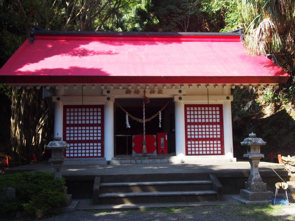
Misaki Shrine
Misaki Shrine is located near the exit of the tunnel.
Surrounded by sub-tropical rain forests, the shrine has the unique atmosphere unlike other Japanese shrines.

Exciting Road to Cape!
There used to be an old observatory and a rest house when I came to this place at the last time, but all those old buildings were removed.
The road to the cape was mostly paved and it has become easier for tourists to walk to the cape than 10 years ago.


The road to the cape is simple and you don’t have to worry about getting lost during at daytime.

At the following picture, my wife was pushing my back so that I walk fast. 🙂 How strong my wife is!

The latitude of Cape Sata is the same as New Delhi of India and Cairo of Egypt. There are many cycad trees and other sub-tropical plants along the road to the cape.
Wonderful View from Road to Cape
I took the photo of east ocean of the cape. I could see the Biro island which we went to by Satadei Go.

The sky was crystal blue. Sea was calm. We felt very happy. (My wife’s sister was impressed by the beauty of the scenery at the following picture.)

I took a photo of the western sea of the cape. The surface of the sea was shining.
I could see Mt. Kaimon at a distance (Sorry that my photo skill was so poor that I could not take the mountain at the following picture!)

I took the following picture on our way to the cape.
It is a bit scary but the beautiful scenery was impressive.

Steep mountains of Cape Sata.

The ocean pacific was very calm on this day.

Clear blue ocean

I was so happy to enjoy the beautiful scenery with my family.

There is a branch road. Turn right if you go to the cape.

If you turn to left there is a lyrics written by Mr. Kawada Jun curved in stone.
The lyric is written in old Japanese. In my translation, it says “The sun coming from the east ocean of Kuroshio current is shining on Cape Sata as if it would never go down”.

I took the following photo in front of the lyrics board.
Standing on Southernmost
I finally stood on the southernmost of Japan’s mainland of 31 degrees latitudes.

The lighthouse stood on the rocky island and it is impossible to reach the lighthouse. The lighthouse is built by English man at the beginning of Meiji Period (second half of the 19th century).
Large container ships and cargo ships were going near the Cape Sata. The lighthouse seems to play an important role for their safe voyage.
I was drenched with sweat.
If the weather is fine, you can see Tanegashima Island and Yakushima Island at south.
It was misty on that day and I could not see those islands.

I also took the video of the scenery at Cape Sata. Please watch and enjoy!

The sunlight was very strong at the observatory at Cape Sata.
Here is an old monument of Cape Sata.

Video “Cape Sata Adventure”
Please watch and enjoy our exploration at Cape Sata Park.
Comment
My family was impressed by the panorama view of Cape Sata.
Beautiful untouched nature and comfortable sea breeze of the southernmost cape will drive away negative feelings completely.
I hope you will come to this place and have the sensational feelings as we did.
Information of Cape Sata
Open Hour
08:00 – Sunset
Entrance Fee
Free
Map of Cape Sata
Southernmost of Japan's Mainland