Details of Mt.SAKURAJIMA
The height is 1,117m
Circumference is about 35km.
Length from east to west is about 12 km.
Lngth from north to south is about 12 km
The gross area of the mountain is about 77km2.
3 main mountains in Sakurajima
The Sakurajima consists of 3 main mountains.
I make introduction of each mountains!
1) Kita-Dake (1,117m)
This is the highest mountain in Mt.Sakurajima. There is a crater of diameter of 500m. Some people called the peak On-Take, but the most common name is Kita-Dake among local people in Kagoshima.
The crater is totally covered with volcanic ash. If it rains, the crater sometimes becomes a small lake.There is no historical record of eruption of crater of the Kita-Dake.
But there is another crater at the north east and it made eruption on 8 November 1779!
See 2 pictures of Crater of Kita-Dake
According to the historical materials, all wells of Sakurajima boiled and massive tidal waves caused many ships sunk. The eruption continued for 3 years and killed as many as 150 people.The erupted ash reached as far as Tokyo and Nagasaki!
My aunt has climbed to the Kita-Dake in her childhood for her school excursion. But now it is prohibited to climb due to active volcanic activities of Mt.Sakurajima.
2) Naka-Dake (1,060m)
Naka-Dake is located at the 900m south of Kita-Dake.
Naka-Dake also has no record of eruption in historical materials. But recent geological surveys revealed that Naka-Dake was created during the eruption activities around DC 1200. Rocky shape of Naka-Dake is impressive. Please see the following picture.
See photo of Crater of Naka-Dake
3) Minami-Dake (1,040m) of 3 crators!
Minami-Dake is located at 500m south of Naka-Dake. There are 3 craters at Minami-Dake.
There is a crater of diameter 700m. The crater is used to be a small lake. There is 2 small craters (A crater and B crater) inside of the crater and they have made small intermittent eruptions since 1955.
It is prohibited to enter 2 kilo meters of the crater of Minami-Dake.
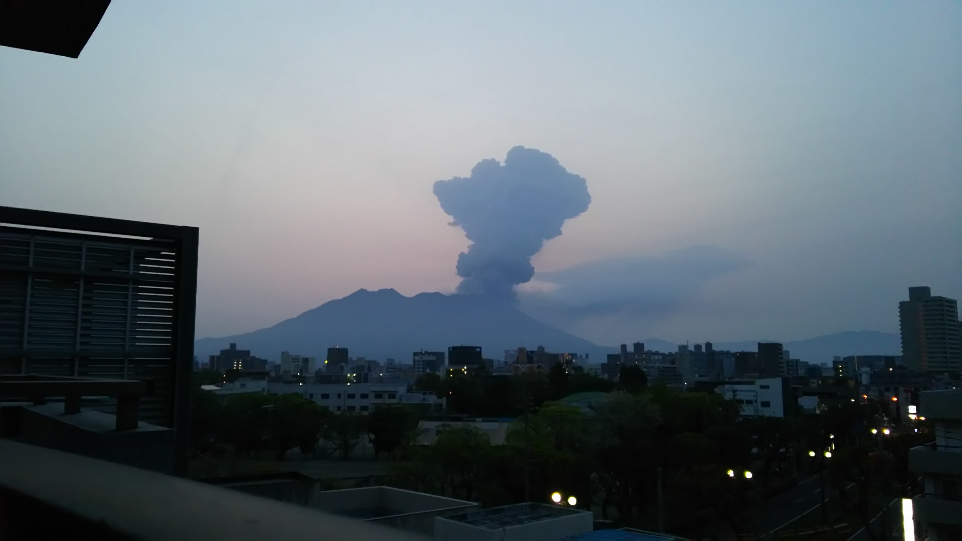
SHOWA CRATOR of Minami-Dake – Most active crater in Sakurajima –
The crater started eruption at east slope of Minami-Dake during World War 2.
The biggest eruption occurred in March of 1946. Much lava covered east areas (Kurokami and Arimura Districts) of Mt.Sakurajima Island.
The crater has kept silent until 2006. The frequency and magnitudes of eruption has got increasingly active than ever.
The following numbers indicate the number of eruption in recent years. ( ) is the eruption of SHOWA crater
Year 2009 – 755(735) eruptions
Year 2010 – 1026(1026) eruptions
Year 2011 – 1355(1353) eruptions (Highest Record!)
Year 2012 – 1107(1105) eruptions
Year 2013 – 1097(1097) eruptions
Year 2014 – 656(655) eruptions
Year 2015 – 555(555) eruptions as of 14 May!
Today’s Sakurajima Video
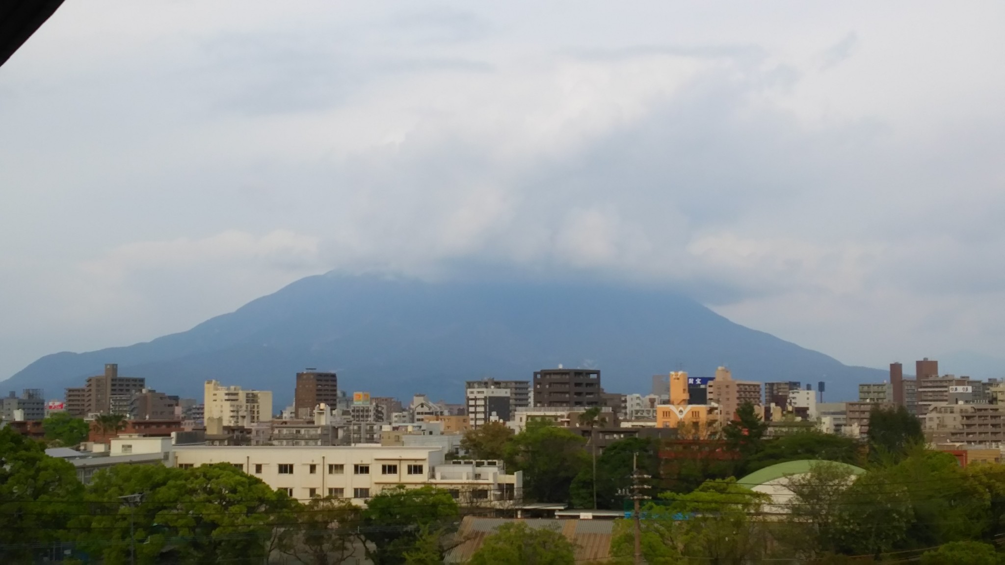
The rainy clouds cover the top of volcano Sakurajima on 15 May 2015.
I hope that the mountain will soon appear from the thick clouds and show me its beautiful shape.